Traveling brings us really memorable experiences and sensations, which we take with us for the rest of our lives. Ironic as it sounds, planning a trip can be a bit of a stressful experience. There are hotel reservations to make, restaurant reservations, activities to plan, tickets to buy. To help you prepare your travel itineraries, we created this post with useful tips to use Google Maps to your advantage.
GPS devices, the internet and other resources facilitate the work of those planning their trips. Today, most smartphones provide mapping applications that are just as effective as GPS devices on the market. One of the best mapping services is Google Maps.
Adjusting the view
In the main menu, it is possible to change the view between several options that bring important information:
Earth – in this option, Google Maps gains 3D modeling, making it possible to see the height of buildings in a city or mountains on a trail, for example;
Traffic – informs the local traffic. Below we will explain in more detail;
Public transport – shows the main metro lines or local buses;
Bike – shows the available bike lanes, according to type, or trails and dirt roads;
Terrain – gives an idea of the local topography through spots on the map.
Looking for the perfect places
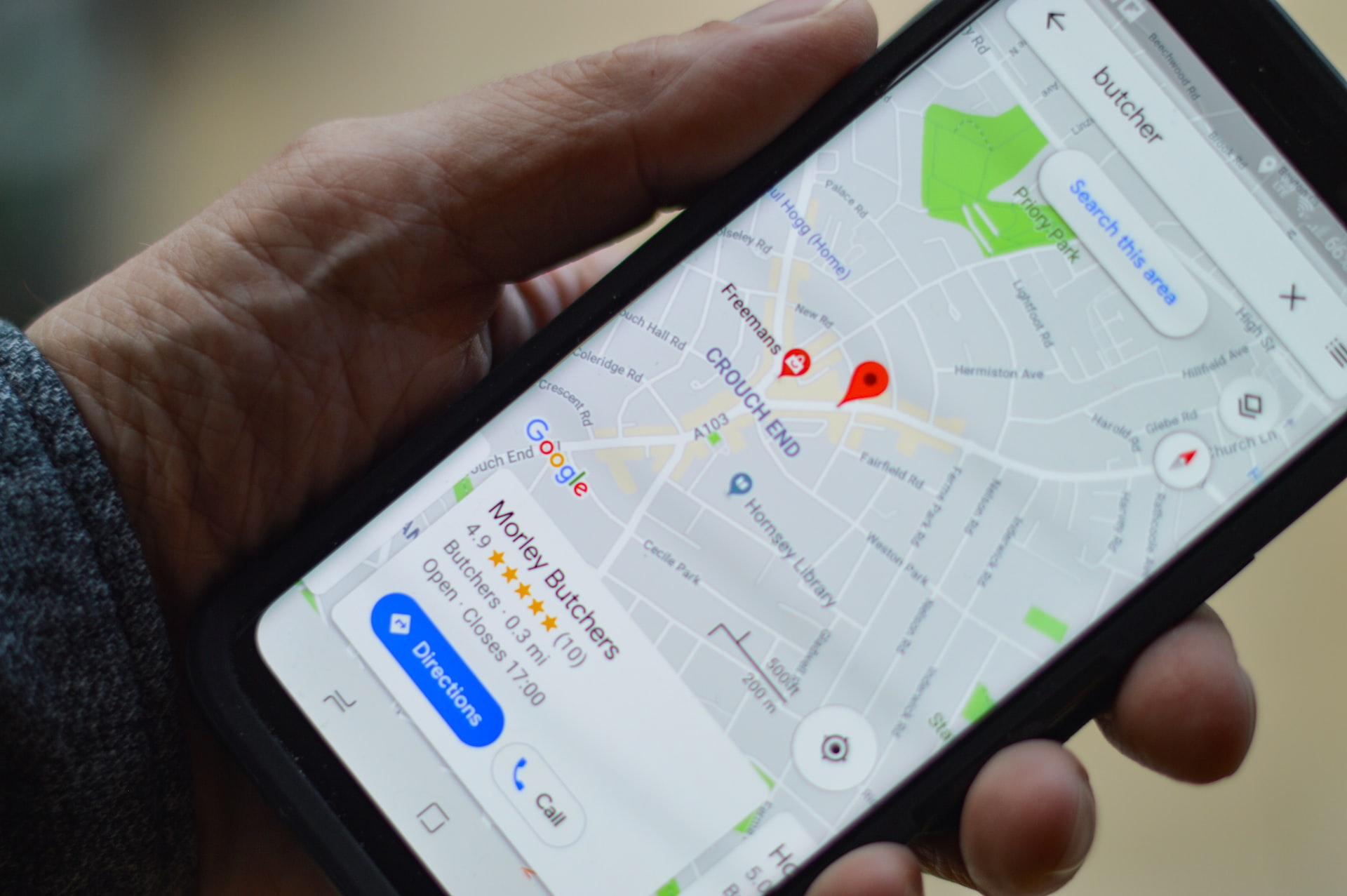
With Google Maps, you can search for hotels directly on the map, which makes it easy to see the distance from the hotel to points of interest.
Just frame the screen with the region where you want to stay, and type the term “hotels” in the search bar. The places cataloged in Google Maps are shown with information on the values.
When clicking on the name of a result, the tool will show detailed information such as contact data and user ratings. There is also the option to save the location, allowing quick queries later.
You can do the same procedure to search for restaurants, cinemas or other attractions.
Another interesting option is, when defining any location, right-clicking the mouse and choosing “in this area, search for”. This will make Google Maps show all the hotels, restaurants, bars and pubs in the area.
No stress in traffic
It doesn’t matter if the option is to go by car, bicycle, bus or even on foot. Google Maps offers many features to make commuting easier. When calculating routes, choose the type of transport to be used and Google Maps will provide relevant information for each situation.
For example, when choosing the public transport option, it will tell you the bus lines and walking routes between one point and another, in addition to the fare in cities where this functionality is available. In the bike option, it will give the route and show an altitude graph, allowing you to choose the paths with less inclinations.
If your travel itinerary includes several locations, you can add destinations to the routes, up to a total of 10. This makes it easy to visualize distances and plan the best itineraries. When defining the route, you can save the data in a PDF file to consult on your smartphone, or even print the map with the directions in step-by-step format.
Exploring locations with Street View
Do you want to see what a place is like before visiting it? Fortunately, it’s possible to explore the area where you’ve planned your vacation using Google Street View. To do this, just drag the yellow doll in the lower right corner to the place you want to explore. The service marks the places where it is available in blue.
Once in Street View, just click on the points where you want to “walk”, or roll the middle mouse button to zoom.
Recently, Google has been adding places where it is possible to explore, even if they are not on roads, such as Machu Pichu, NASA or the Disney parks.
Customize with the My Maps function
With this feature, you can create custom maps with a variety of specific information that is made available through layers. The interesting thing about My Maps is that you can suppress or display information as needed, take notes and even save to consult offline.
After the trip, contribute!
By leaving the location options activated on the smartphone , Google catalogs the places visited and allows you to evaluate them. This collaborative function helps when deciding which places to visit and can yield freebies in Google’s collaboration program.